News Summary
The National Weather Service has issued severe thunderstorm warnings for the Charleston region, including Coastal Colleton and Beaufort counties. Residents are advised to stay alert as the storms may cause gusty winds and other hazards. Safety recommendations include seeking shelter, monitoring updates, and exercising caution while driving due to potential hydroplaning risks. The NWS emphasizes staying connected to local news for the latest information on the evolving weather situation.
Severe Thunderstorms Prompt Warnings in Charleston Area
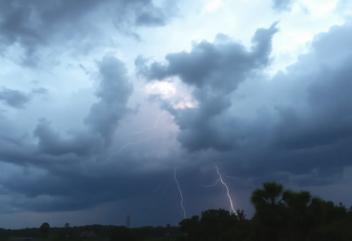
Charleston, SC – The National Weather Service (NWS) has issued severe thunderstorm warnings for multiple regions in the Charleston area, including Coastal Colleton and Beaufort counties. The alerts were made effective at approximately 8:06 p.m. on Monday, warning residents of potential hazards until 8:30 p.m.
At the time of the warning, Doppler radar detected a strong thunderstorm located 7 miles southwest of Bennetts Point, which was reported to be nearly stationary. Residents in affected areas such as Beaufort, Bennetts Point, Fripp Island, Dale, Eddings Point, Coffin Point, Coosaw Island, Dataw Island, Frogmore, and Harbor Island are advised to stay alert to the storm’s developments.
Concerns over this storm include the risk of gusty winds, capable of bringing down tree limbs and displacing unsecured objects. The NWS strongly encourages individuals to remain connected to NOAA Weather Radio All Hazards or local news reports for the latest information and updates regarding the weather situation.
A previous weather alert was issued earlier in the day at 3:47 p.m. for Charleston and Dorchester counties, warning of strong thunderstorms that were projected to last until 4:30 p.m. Doppler radar indicated that a strong thunderstorm was located about 5 miles north of Delemar Crossroads and was also reported as nearly stationary. Communities significantly impacted by this weather alert included Summerville, Delemar Crossroads, Knightsville, Clubhouse Crossroads, Canaan, Westoe, Slands Bridge, Slandsville, Cooke Crossroads, and Gettysville.
Lightning Safety and Thunderstorm Facts
The NWS also noted a concerning statistic regarding lightning, as approximately 25 million lightning strikes occur annually across the United States, primarily during the summer months. These lightning events tragically result in around 20 fatalities each year. The likelihood of lightning strikes increases as thunderstorms approach, peaking when the storm is directly overhead. Therefore, it is critical for residents to be aware of safety recommendations concerning lightning and thunderstorms.
Safety tips during thunderstorms include seeking indoor shelter whenever possible. However, in situations where shelter is not available, individuals should take precautionary measures to minimize risk. The NWS urges residents to closely monitor weather updates and pay attention to any further alerts.
Driving Safety During Storms
Heavy rainfall can also lead to hazardous driving conditions, particularly through a phenomenon known as hydroplaning. Hydroplaning occurs when water accumulation in front of a vehicle’s tires exceeds its weight capacity, causing the vehicle to slide uncontrollably on a thin water layer. The three primary contributors to hydroplaning incidents include excessive speed, worn tires, and wet road surfaces. Drivers are advised to exercise caution when navigating wet roads to prevent such occurrences.
In the event of hydroplaning, there are specific guidelines that drivers should follow. This includes remaining calm, avoiding abrupt steering movements, and gently easing off the accelerator to regain control of the vehicle.
As severe weather events like these can pose significant risks to safety, residents are urged to remain vigilant, prepare accordingly, and heed the guidance provided by the National Weather Service.
Deeper Dive: News & Info About This Topic
HERE Resources
Severe Thunderstorm Warning Issued for Charleston Area
Beaufort Water Festival Opening Night Canceled Due to Weather
Severe Thunderstorm Warning Issued for Charleston Area
Beaufort County Storm Warning Update
Severe Thunderstorm Alert Issued for Hilton Head Island
Beaufort Water Festival Opening Night Canceled Due to Weather
Major Heat Wave Set to Impact 255 Million Americans
Severe Thunderstorm and Tornado Warnings Issued for Beaufort
Severe Thunderstorm Watch Issued for Coastal South Carolina
Severe Thunderstorm Watches and Warnings Issued for Charleston Area
Additional Resources
- Herald Online: Severe Weather Update
- Wikipedia: Weather Warning
- Live 5 News: Thunderstorm Warning
- Google Search: Thunderstorm Precautions
- Myrtle Beach Online: Weather News
- Google Scholar: Severe Thunderstorm Warnings
- ABC News 4: Severe Thunderstorm Warning
- Encyclopedia Britannica: Thunderstorm
- Count on 2: Thunderstorm Warning Issued
- Google News: Thunderstorm Alerts