Charleston, SC, August 22, 2025
News Summary
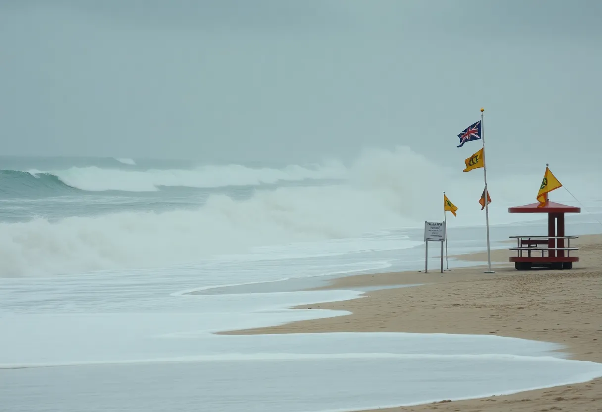
The National Weather Service has issued a high surf advisory for Charleston, SC, effective until 5 p.m. Beachgoers are warned of large waves and dangerous rip currents as Hurricane Erin approaches. Swimmers are advised to exercise caution and remain close to lifeguard stations. The potential for hazardous surf conditions is expected to last through the weekend, with weather forecasts indicating heavy rainfall as well. Community safety preparations are underway in light of the storm’s impact.
Charleston, SC: High Surf Advisory and Rip Current Risks Issued as Hurricane Erin Approaches the Lowcountry
The National Weather Service (NWS) in Charleston, SC has issued an updated high surf advisory for the coastal areas of Jasper and Beaufort County, effective from Thursday at 7:31 a.m. until 5 p.m. The advisory is prompted by the approach of Hurricane Erin, a Category 2 storm with maximum sustained winds of 105 mph, which is expected to affect 15 states through Friday.
Beachgoers are warned about large breaking waves that could reach heights of up to 5 feet in the surf zone, leading to dangerous swimming and surfing conditions. The NWS cautions that rip currents can pose a significant hazard, even for experienced swimmers, potentially pulling them offshore into deeper waters. Inexperienced swimmers are strongly recommended to stay out of the water during these perilous surf conditions.
The NWS emphasizes the need for safety, advising swimmers to remain close to lifeguard stations. If caught in a rip current, individuals should remain calm, float, and avoid swimming against the current. Those unable to escape should face the shore and wave for assistance.
Weather Forecast and Impact
Wave heights are forecasted to range between 5 to 7 feet on Thursday, with a continued high risk of rip currents expected through Friday. Conditions are projected to remain hazardous for swimming and surfing throughout the weekend, and heavy rainfall is also a possibility as showers and storms develop, particularly towards the end of the week.
A slow-moving front is anticipated to enhance shower and storm activity on Friday, with lingering rain chances into Saturday. However, the situation is expected to improve on Sunday, with decreasing chances of rainfall.
Safety Measures and Preparedness Efforts
Officials on Sullivan’s Island and the Isle of Palms are actively preparing for the impacts of Hurricane Erin, with public safety being a top priority. The Isle of Palms Police, along with local meteorologists, have highlighted the importance of collective efforts to keep beachgoers safe. To indicate rip current dangers, a colored-flag system will be utilized on the beaches.
The Isle of Palms Fire Department is closely monitoring the evolving conditions and may deploy specially trained aquatic rescue teams if the situation mandates it. Residents within these communities have expressed appreciation for the ongoing flow of information regarding safety protocols during the storm.
Understanding Hurricane Erin
Hurricane Erin is currently moving toward the U.S. shoreline after spending 10 days at sea. The storm’s cloud canopy spans from the Bahamas to southern New England, covering a considerable distance of more than 1,000 miles. Preparations along the coast are vital to ensure the safety and awareness of all residents and visitors as the hurricane’s effects loom.
Conclusion
As Hurricane Erin approaches, residents and beachgoers in the Lowcountry area are urged to heed all safety advisories and remain vigilant. The combination of high surf and rip current risks, paired with potential thunderstorms, highlights the importance of staying safe while enjoying local beaches.
Frequently Asked Questions
What is a high surf advisory?
A high surf advisory warns of dangerous surf conditions and large breaking waves that can create hazardous swimming and surfing conditions, as issued by the National Weather Service.
What should swimmers do if caught in a rip current?
Swimmers should remain calm, float, and avoid swimming against the current. If they are unable to escape, they should face the shore and signal for help.
How long will the high surf advisory last?
The current high surf advisory is effective until 5 p.m. on Thursday, with a high risk of rip currents expected to continue into Friday and a moderate risk remaining throughout the weekend.
What preparations are being made for Hurricane Erin?
Officials on Sullivan’s Island and Isle of Palms are preparing for the storm’s impacts, including a colored-flag system for rip current warnings and monitoring conditions closely.
What might the weather look like over the weekend?
While hazardous conditions for swimming and surfing are expected to persist through the weekend, rain chances are anticipated to decrease by Sunday.
Key Features of the Storm Advisory
| Feature | Details |
|---|---|
| Advisory Issued | High Surf Advisory until 5 p.m. Thursday |
| Wave Heights | 5-7 feet on Thursday |
| Rip Current Risk | High risk through Friday, moderate into the weekend |
| Rain Forecast | Increased chances of heavy downpours Friday and Saturday |
| Hurricane Category | Category 2 with sustained winds of 105 mph |
| Geographical Impact | Affects 15 states from Bahamas to southern New England |
Deeper Dive: News & Info About This Topic
HERE Resources
Severe Thunderstorm Warning Issued for Beaufort and Colleton Counties
Flood Advisory Canceled for Beaufort and Jasper Counties
Charleston Issues Coastal Flood Advisory as Tides Rise
Dense Fog Advisory Issued for South Carolina and Southeast
Severe Thunderstorm Alert Issued for Hilton Head Island
Beaufort County Under Flood Advisory Due to Heavy Rain
Tragic Drownings in Beaufort County Amid Rip Current Risks
Tragic Drownings Highlight Rip Current Dangers in Beaufort County
Traffic Delays Anticipated Due to Construction in Beaufort
Protests Planned Across South Carolina on Flag Day
Additional Resources