News Summary
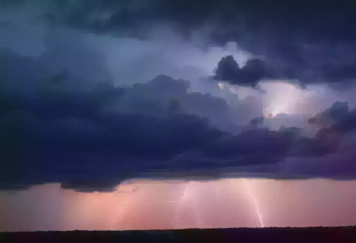
Severe thunderstorm and tornado warnings were issued for Beaufort and Jasper counties as storms moved through the area, bringing gusts of up to 60 mph. Residents were advised to seek shelter and stay away from windows to avoid injury from debris. The National Weather Service warned of potential damage and power outages. A previous tornado warning was lifted earlier in the day with no confirmed tornadoes reported. Additional rain and wind are expected as the weekend continues, prompting ongoing alerts for local residents.
Beaufort, SC – Severe thunderstorm and tornado warnings were issued for Beaufort and Jasper counties as severe weather conditions persisted on Sunday. An updated severe thunderstorm warning from the National Weather Service (NWS) Charleston SC was released at 5:37 p.m., effective until 6 p.m. Wind gusts reaching up to 60 mph are anticipated as a thunderstorms move through the area.
At the time of the warning, a severe thunderstorm was located over Parris Island, advancing eastward at a speed of 20 mph. The NWS alerts residents of the potential for damage to roofs, siding, and trees, as well as power outages due to downed lines.
Areas under the severe thunderstorm warning include Hilton Head Island, Beaufort, Port Royal, Shell Point, Parris Island, Burton, Lemon Island, Laurel Bay, Calawassie Island, and Ladys Island. Residents are urged to seek shelter in a sturdy building and to stay away from windows to avoid injury from potential flying debris.
Later in the evening, a second severe thunderstorm warning was issued by the NWS Newport/Morehead City NC at 10:03 p.m., lasting until 10:15 p.m., for Beaufort and Pitt counties. This warning also anticipates wind gusts up to 60 mph, with the storm located over Washington moving east at 30 mph. Affected areas include Washington, River Road, Bunyan, Old Ford, Goose Creek State Park, Chocowinity, Washington Park, and Grimesland.
Throughout the United States, thunderstorms contribute to approximately 25 million lightning strikes annually, primarily occurring during the summer months, leading to around 20 fatalities each year. The likelihood of lightning strikes rises as the storm approaches, peaks when directly overhead, and then diminishes as it moves away.
In cases of thunderstorms, safety advice recommends moving to the lowest floor of a structure and seeking shelter in an interior room to reduce the risk of injury. Additionally, drivers should remain cautious during heavy rains as hydroplaning – where a vehicle glides uncontrollably on wet roads due to water accumulation under the tires – can occur. The top causes of hydroplaning include high speed, insufficient tire tread, and standing water on the roadway.
This series of weather warnings follows a tornado warning that was previously issued for Beaufort and Jasper counties earlier in the day at 11:06 a.m., when radar indicated a severe thunderstorm capable of producing a tornado near Bluffton. The tornado warning was lifted around 11:30 a.m. after the storm weakened and moved offshore, and no confirmed reports of a tornado touching down in the region were received. The warning had previously suggested imminent danger to life and property, urging residents to take cover from risks such as flying debris.
As the weekend continues, additional rain is expected in the Charleston area alongside wind gusts ranging from 20 to 30 mph. Residents in Beaufort and Jasper counties are advised to stay alert and monitor local weather for updates as these severe weather conditions evolve.
Deeper Dive: News & Info About This Topic
HERE Resources
Severe Flooding in San Antonio Leaves at Least 11 Dead
Single-Vehicle Motorcycle Crash Claims Life in Beaufort County
Columbia Prepares for Potential Winter Weather
South Carolina Braces for Severe Winter Weather
Severe Thunderstorm Watch Issued for Coastal South Carolina
Severe Thunderstorm Watches and Warnings Issued for Charleston Area
Severe Weather Prompts Governor’s Emergency Measures Across Texas
Charleston Prepares for Severe Weather and Flooding Risks
Beaufort County Under Tornado Watch as Hurricane Helene Approaches
South Carolina Battles Widespread Wildfires Amid Emergency
Additional Resources
- Charlotte Observer: Severe Weather Alerts
- Wikipedia: Thunderstorm
- Myrtle Beach Online: Weather Updates
- Google Search: Thunderstorm Safety
- Post and Courier: Tornado Warnings
- Google Scholar: Severe Thunderstorm Impact
- Bluffton Today: Winter Storm Warnings
- Encyclopedia Britannica: Lightning